$2,350/
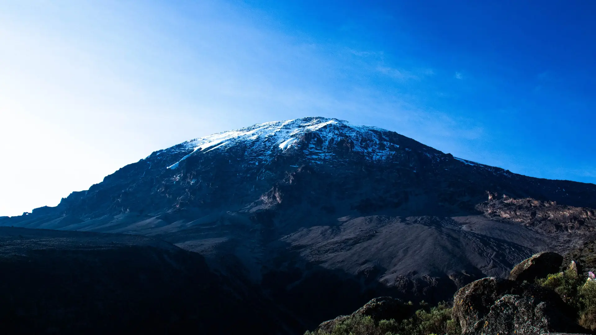
Per PersonThe Lemosho Route is one of the most scenic and less crowded paths to climb Mount Kilimanjaro in Tanzania, often favored for its beauty and gradual acclimatization profile. Typically taking 7-8 days, the route begins at the lush rainforest of Londorossi Gate and traverses diverse landscapes, including heath, moorland, and alpine desert, before joining the Machame Route near the Lava Tower. With fewer trekkers and a longer route, Lemosho offers more time to adapt to the altitude, making it one of the best options for increasing summit success rates while providing stunning views and varied terrain throughout the journey.
Included and Excluded
- Meal As Per Hotel Plan And Drinks Free Too.
- Return Airport And Round Trip Transfers.
- Accommodation On Twin Sharing Basis.
- The Above Rates Are On Per Day Disposal Basi
- Enjoy Brussels Day Tours. Overnight Brussels
- AC Will Not Be Functional On Hills Or Slopes.
- Any Other Service Not Mentioned
- Additional Entry Fees Other Than Specified
- Amsterdam Canal Cruise Not Included For Basic
Highlights of the Tour
- Our Team Of Knowledgeable Guides And Travel Experts Are Dedicated To Making Your Journey Memorable And Worry-Free
- Dive Into Rich Cultures And Traditions. Explore Historic Sites, Savor Authentic Cuisine, And Connect With Locals.
- We Take Care Of All The Details, So You Can Focus On Creating Memories. Rest Assured That Your Journey Is In Capable Hands
- Sip Cocktails On The Beach As You Watch The Sun Dip Below The Horizon.
- From Accommodations To Dining Experiences, We Select The Best Partners To Ensure Your Comfort And Enjoyment Throughout Your Journey.
Itinerary
After registration at Londorossi Gate, the drive continues to the Lemosho trailhead. The trek begins in a lush rainforest with abundant flora and potential wildlife sightings, including black-and-white colobus monkeys. Overnight at Mti Mkubwa Camp.
- Elevation: 2,100m to 2,650m (6,890ft to 8,694ft)
- Distance: 6km
- Hiking Time: 3-4 hours
- Begin in the rainforest, where you'll likely encounter wildlife and lush scenery.
Leaving the forest, you enter the moorland zone, marked by shrubbery and heathers, and ascend to Shira Plateau. You’ll pass through Shira 1 Camp and continue onward to Shira 2. Here, the scenery opens up, revealing views of Kilimanjaro’s glaciers.
- Elevation: 2,650m to 3,850m (8,694ft to 12,631ft)
- Distance: 16km
- Hiking Time: 7-8 hours
- Trek through moorland to Shira Plateau.
This is an acclimatization day, where you'll trek to Lava Tower (4,600m) and then descend to Barranco Camp. The ascent to Lava Tower is challenging, but descending to Barranco helps with acclimatization. Barranco Camp sits in a scenic valley with views of the Barranco Wall.
- Elevation: 3,850m to 3,900m (12,631ft to 12,795ft) via Lava Tower (4,600m)
- Distance: 10km
- Hiking Time: 7 hours
- Acclimatization day with a trek up to Lava Tower before descending to Barranco.
The day starts with a scramble up the Barranco Wall (also known as the “Breakfast Wall”), which requires some hands-on climbing but is not technical. Afterward, you'll continue through Karanga Valley before reaching Barafu Camp. Rest and prepare for the midnight summit push.
- Elevation: 3,900m to 4,673m (12,795ft to 15,331ft)
- Distance: 13km
- Hiking Time: 8-9 hours
- Climb the Barranco Wall, passing through the Karanga Valley to reach Barafu Camp.
At midnight, you start the summit ascent in cold and windy conditions, climbing to Stella Point on the crater rim, then continuing to Uhuru Peak. After sunrise and photos at the peak, descend to Barafu for a short rest before continuing down to Mweka Camp.
- Elevation: 4,673m to 5,895m (15,331ft to 19,341ft), descent to 3,068m (10,065ft)
- Distance: 17km
- Hiking Time: 12-15 hours
- Midnight summit attempt, reaching Uhuru Peak at sunrise, then descending to Mweka Camp.
A final descent through the rainforest to Mweka Gate, where you’ll collect your certificates before returning to Moshi.
- Elevation: 4,673m to 5,895m (15,331ft to 19,341ft), descent to 3,068m (10,065ft)
- Distance: 17km
- Hiking Time: 12-15 hours
- Midnight summit attempt, reaching Uhuru Peak at sunrise, then descending to Mweka Camp.
Location Map
Book Your Tour
Reserve your ideal trip early for a hassle-free trip; secure comfort and convenience!
